

Flag Design of the Martian Congressional Republic
As you know, I am a cartographer and I love to play around with maps. Since a lot is going on Earth when it comes to cartography and geo-science, less is happening about Mars.
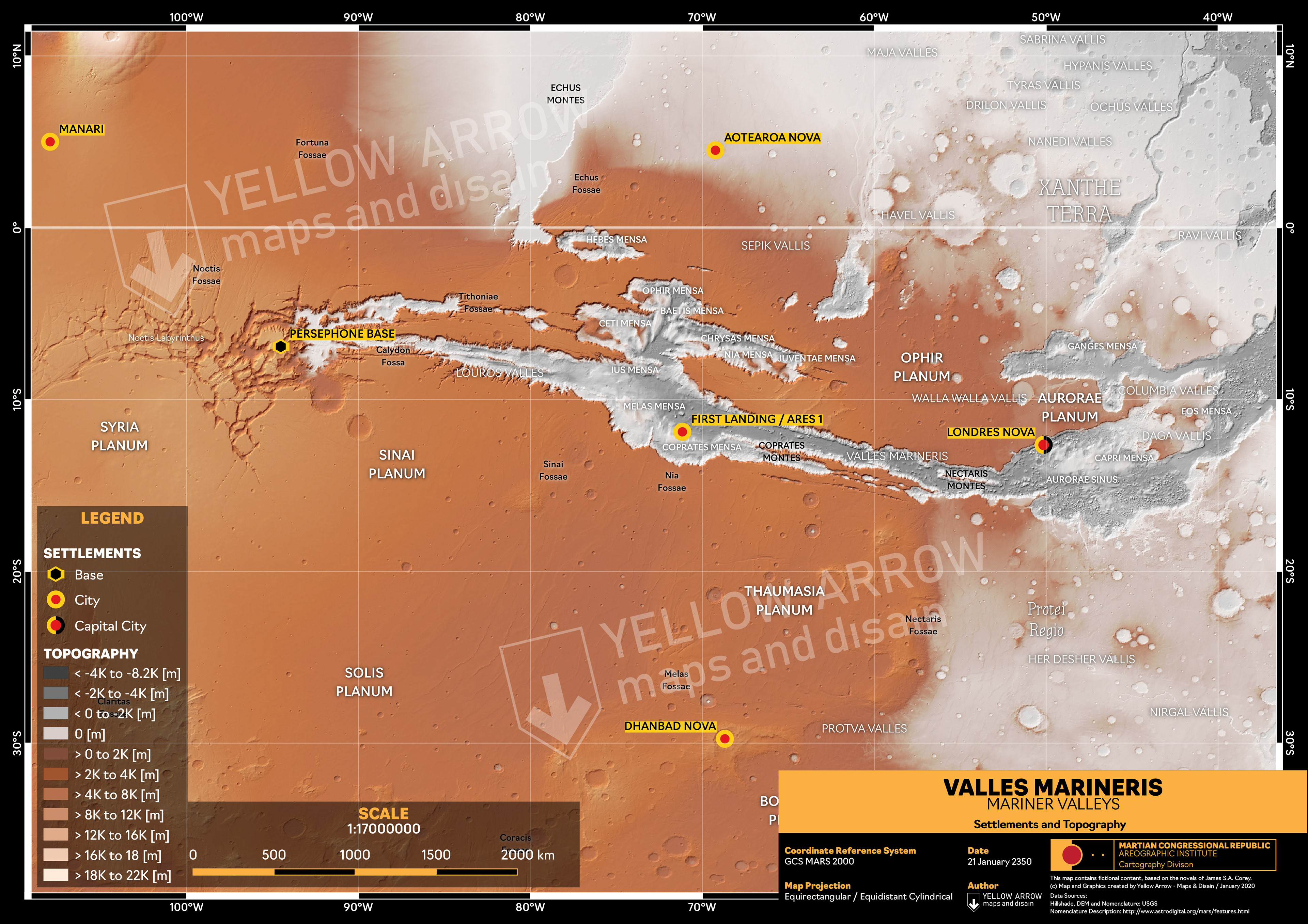
Since a while I am playing around with open geospatial Mars data from the USGS, I lost a bit of interest over time and then, "The Expanse" happened. On of the best Scifi shows I have seen in recent years. Mars plays an important role in this fictional universe and so I picked up the idea again, searched the net for reference material to map Mars new.
Since a while I am playing around with open geospatial Mars data from the USGS, I lost a bit of interest over time and then, "The Expanse" happened. On of the best Scifi shows I have seen in recent years. Mars plays an important role in this fictional universe and so I picked up the idea again, searched the net for reference material to map Mars new.

Coat of Arms Design
of the MCR
The first step looks already very promising, but I would like to develop this idea further. My goal would be a very detailed map of Mars and the MCR (Martian Congressional Republic), that shows all settlements and infrastructure.
The challenge: let it look plausible, real and conform with cartographic rules.
The challenge: let it look plausible, real and conform with cartographic rules.
I am sourcing the Expanse wiki for exact locations of them but I would also like to generate a much more detailed map of the Mariner Valley especially since this map gives a bit of a wrong impression in which Mars seems not very crowded but according to the stories, 4-9 billion people live there.
However, some work is done but new ideas keep rolling in.
Stay tuned!
However, some work is done but new ideas keep rolling in.
Stay tuned!